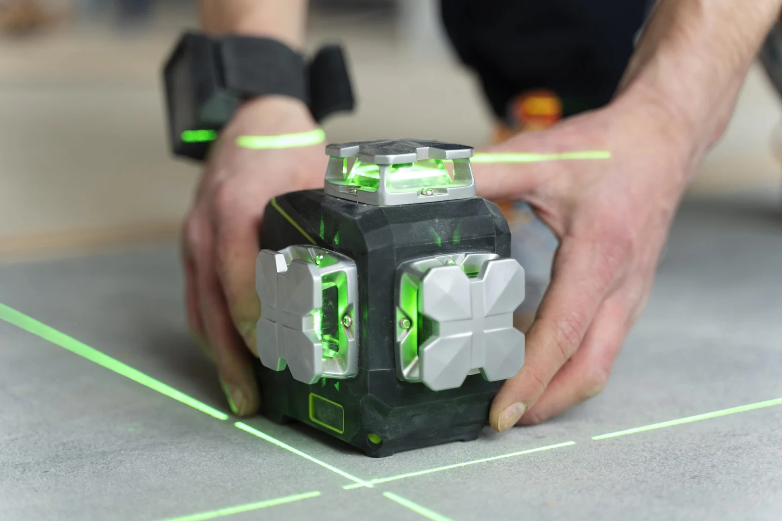
Terrestrial Laser Scanning (TLS) uses advanced LiDAR technology to collect millions of measurements in seconds, creating a highly accurate 3D representation of any environment. We use TLS for industrial facilities, commercial buildings, accident reconstruction, and forensic documentation—delivering clean, organized data ready for CAD, BIM, and legal use.
With TLS, we can document complex environments with exceptional detail and minimal disruption.
Our scanners capture geometry, structures, equipment, vehicles, and entire rooms with millimeter-level accuracy.
We deliver complete, engineering-grade and court-ready outputs:
We arrive with advanced TLS equipment and capture the entire scene quickly, safely, and accurately.
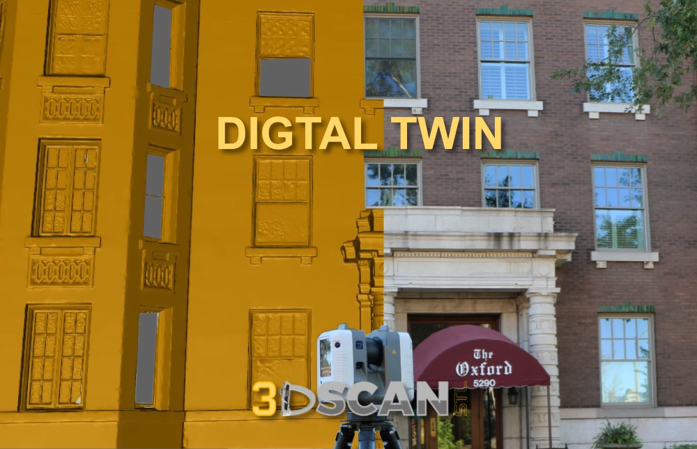
Scans are aligned, cleaned, and organized into a precise 3D dataset.
Receive engineering-ready, BIM-ready, or court-ready files in your preferred formats.
A manufacturing plant required updated as-builts before installing new equipment. TLS data helped engineers avoid pipe clashes and reduced rework costs.
We scanned an entire floor, mapping elevation deviation. The architect used our analysis model to plan the improvements with zero return site visits.
Law enforcement needed exact measurements of a multi-car accident. TLS provided objective 3D documentation that supported courtroom reconstruction.
“Their forensic scans were incredibly helpful for courtroom presentation. Highly professional.”
“Accurate scans, clean data, and fast delivery. Exactly what we needed for our plant retrofit.”
“The TLS point clouds dropped straight into Revit with zero issues. Excellent service.”
Terrestrial Laser Scanning (TLS) is a ground-based LiDAR technology that rapidly captures millions of precise 3D data points to create highly accurate 3D models, photorealistic images, and detailed real-time measurements of physical objects, structures, and environments. It works by spinning a laser to measure distances and angles to surfaces, producing dense “point clouds” for applications like construction, forensics, heritage conservation, and infrastructure inspection.
TLS captures millions of data points in a single scan, delivering highly accurate and precise measurements. The latest devices ensure +-1mm accuracy of the single scan, this level of detail is invaluable for creating as-built models, conducting topographic surveys, and ensuring design accuracy. It eliminates human error, and the measurement inaccuracies are often associated with traditional surveying methods. TLS captures millions of data points in a single scan, providing highly accurate and precise measurements. The latest devices ensure +/-1mm accuracy of each scan, and this level of detail is invaluable for creating as-built models, conducting topographic surveys, and ensuring design precision.
Yes, we offer industrial as-built services, documenting final dimensions, locations of equipment, pipes, conduits, and changes from original plans for warehouses, manufacturing, and large facilities. These deliverables (drawings/models) ensure compliance, facilitate maintenance, and aid future renovations.
Yes, crime and accident scenes are increasingly being scanned with 3D laser scanners to create precise, virtual replicas for detailed analysis, preservation, and courtroom presentation. The owner has served in Law Enforcement and the Fire Service. So this is very much a priority for us. We offer highly detailed 3D Laser Scanning (TLS) specifically for this purpose.
Turnaround time is dependent on numerous factors, such as the size and scope of the project and the urgency to receive the results. Every job is different. Therefore we tailor our services to your needs and give you a realistic timeframe in which you can expect to receive your deliverables.